The Economist explains Why Africa’s borders are a mess
November 19, 2016
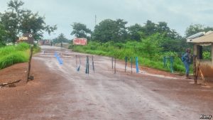
ARGUMENTS over parking spaces rarely turn into international incidents. Not so in June last year at Vurra, on the border between Uganda and the Democratic Republic of Congo (DRC). Young Congolese walked 300 metres beyond the customs post ostensibly to build a parking yard, in what they said was no man’s land. Ugandans demurred, blocking the road with logs. The border was closed for two months. Such confusion is not unusual in Africa. Only a third of its 83,000km of land borders is properly demarcated. The African Union (AU) is helping states to tidy up the situation, but it has repeatedly pushed back the deadline for finishing the job. It was meant to be done in 2012, then 2017, and now, it was announced last month, in 2022. Why is it so hard to demarcate Africa’s borders and why does it matter? Most pre-colonial borders were fuzzy. Europeans changed that, carving up territory by drawing lines on maps. ‘We have been giving away mountains and rivers and lakes to each other,” mused the British prime minister, Lord Salisbury, in 1890, “only hindered by the small impediments that we never knew where the mountains and rivers and lakes were.” It took 30 years to settle the boundary between Congo and Uganda, for example, after the Belgians twice got their rivers muddled up. In 1964 independent African states, anxious to avoid conflict, agreed to stick with the colonial borders. But they made little effort to mark out frontiers on the ground. Pity the bureaucrats who have to sort out this mess. Their quest begins with dusty documents, often held in European archives. Old treaties may refer to rivers which have changed course, or tracks that have disappeared. Then teams of GPS-wielding surveyors must traipse through rugged borderlands, erecting pillars, reassuring locals and in some places dodging landmines. Above everything, inevitably, is politics. Many borderlands are coveted for pasture or minerals: disputed lakes harbour oil, gas and fish. Climate change and population growth are putting pressure on resources, making conflicts harder to resolve. The contest over Abyei, on the relatively new international border between Sudan and South Sudan, is illustrative: its knotty history goes back to the drawing of provincial boundaries in 1905, and takes in ethnic conflicts sharpened by civil war, growing competition for grazing lands and oil fields that until recently produced a quarter of Sudanese output. Full-blown territorial wars have been rare in Africa when compared to the history of Europe. But 19 border disputes are bubbling across the continent, says Fred Gateretse-Ngoga, the AU’s head of conflict prevention. In 1998 Ethiopia and Eritrea went to war over a border town, citing different interpretations of colonial treaties. Nigeria and Cameroon almost did the same over a peninsula (the International Court of Justice ruled in Cameroon’s favour in 2002). Fixing frontiers would cement peace and help local economies. Mali and Burkina Faso, which have twice gone to war, now share a joint health clinic on the border. Perhaps Uganda and the DRC, which launched a $200,000 joint demarcation exercise in Vurra last April, should consider sharing a car park. *The Economist